A Timely Visit to Talk Weather
The day before our storm, Channel 8’s meteorlogist Ted McInerney visited our school and taught us about weather. He shared the forecast for the very next day: an intense storm starting with snow and changing over to rain, with over an inch of rain expected. A major concern would be winds that could gust 60 or more miles per hour at the time of the high tide – one of the very highest of the month, coinciding with the new moon. Warnings about potential power outages, high winds and coastal flooding along Maine’s entire coast were in effect. We wondered if we’d have a school day cancellation, but I don’t think any of us expected how wild the storm would be.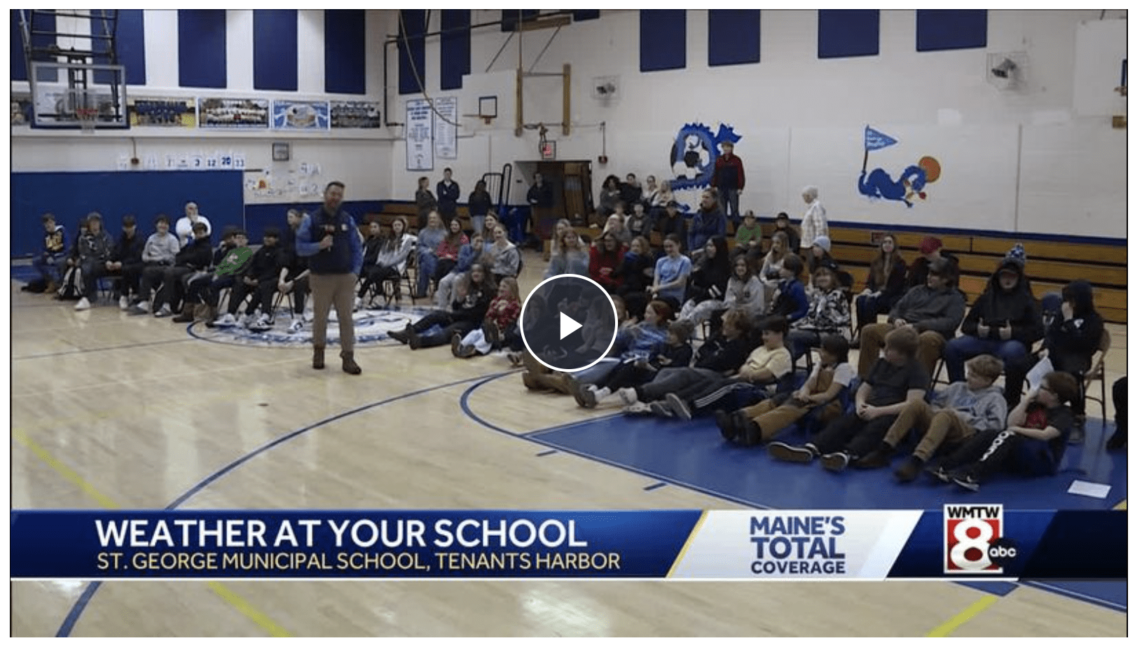
Rt 131, Martinsville Bridge (photo by Anne Cox)

The road by along Drift Inn Beach (photo by Judi Maine)

Some Observations and Experiences
“The craziest thing was the Drift Inn Beach’s road being uprooted from the ground and being destroyed. Another thing I saw was a road on the way to Walmart underwater and cars stuck on it. This all amazed me because I’ve never seen anything like it.”
“(Our) power went out around five in the morning and didn’t come back until around one. A large portion of my backyard was completely flooded by the rain, and my pool was almost full again. My mom took me to my cousin’s house at around ten, and on our way there we saw plenty of damage to the roads, we saw a huge tree downed on a power line that had snapped from the midsection up and had fallen completely off, and we drove over a downed power line.”
“Usually I can’t hear the wind too bad but during this storm I could hear the wind hitting the sides of my house. This made very loud banging noises. I could feel the house shake slightly from the wind and hear trees falling down in the woods. Nothing really flooded that I saw around me but when we left my house all the areas with water were just keeping the water from being on the road. Most culverts were filled to the top with water, I was thankful that the water wasn’t in the road. After the storm there were lots of trees fallen down on roads. A tree almost fell on our parked car and a building next to our house. It was luckily caught by other trees near by. It’s concerning due to the fact we live in the woods with trees surrounding our house. Knowing that is scary as any tree could fall down and hit our house or cars.”
“I saw that many docks were covered with water and a photo of a dock and the gas pumps that were normally on the dock were in the water and one of the sheds that was on the dock was just floating in the water. I woke up early in the morning because I wanted to see how bad the storm was and when I looked out my window it was insane how much water from the rain there was and the amount of wind was crazy. I also saw photos of the tar that was ripped off the road. I kind of know property owners that were affected because there is a road in Port Clyde that me and my dad mow the houses on and the houses are right next to the water and there was a ton of rocks at the houses and there was seaweed everywhere. The storm is kind of concerning because the amount of damage that was done and I wonder how much damage will be done tomorrow.”
“I first heard the storm while I was sleeping. I heard lots of rain and wind pushing up against my window. When I woke up, most of the snow was gone, which made me a little sad. My yard was flooded and looked like someone tried to build a pool. My flagpole had snapped in half and was rolling around on my driveway. My mom and stepdad had left to go check on the wharf which was completely flooded. It was so flooded that the ocean water had gone over the electrical box. There were things floating in the water which people who go the wharf helped pick up. The float that holds the skiffs was higher than the cement part that is attached to the float. While my mom and stepdad were gone I had to take the dog outside. While I was out there I was standing at the end of my driveway and I looked up and there were trees swaying almost completely sideways at 90 degrees. I took a video and just hoped none would fall, especially on any buildings in my yard. I only knew of one person that I’m close to that was affected. I think the owner of the wharf was pretty affected after probably losing some things off the wharf and the electrical box being flooded with water. This storm was pretty concerning because we’re having (several) storms in almost one week. I think this is part of global warming and how its really affecting weather change and other things.”
“I woke up at night during the storm because the wind was howling. Outside my bedroom window there is a bunch of dead trees, this is concerning to me because I don’t want to wake up with a tree on top of me. The power went out at my house but CMP was surprisingly fast in getting the power back on. After the wind let up my mom and I went out to see the damage to wharves and roads. We went to Marshall Point and saw that the road washed out. As she was driving I could see many trees down, damage to the road and ocean water flooding wharves. This was a concerning storm because of the hurricane winds. These storms get their power from topical waters. This means that our oceans are getting warmer, this could be devastating for our economy that primarily relies on our oceans.”
“We lost power at 5:09 AM. About halfway through the day, my mom and dad went down our road to check on the other people and get trees out of the road so that the power company could come down and fix our wires. My parents also went to Marshall Point Road and the lighthouse to see the damage there. On the road to the lighthouse there are huge chunks of pavement every where.”

Spruce Head, Photo Credit Ryker Baum

Spruce Head, Photo Credit Ryker Baum
“On Clark Island the causeway got demolished. It’s impossible to drive a car on it and the people who live on the island cannot get off. The causeway is covered in rocks, seaweed, and other debris and it will probably have to get rebuilt.”
“One of my dad’s friend’s shop is GONE! It flooded it away.”
“When I woke up and looked out my window during the storm I saw the tops of the trees violently swaying and shaking. There wasn’t very much rain but there was a ton of wind which made the rain pound against my house. This made the sound of rain very loud when it bounced off my windows. When I went outside it wasn’t bone chilling cold but it was very uncomfortable with the wind and the rain slamming into my body. I went back inside and looked into my backyard and saw my pond overflowing almost completely submerging my dock. After the storm ended my parents informed me that the road in front of Drift Inn was destroyed and the bus could no longer come that way. So for the rest of the year I would have to walk down to the Black Harpoon as my new bus stop. This storm didn’t affect me directly but it affected my community, especially my wharf, greatly. I would think that it would lengthen the amount of time that it is going to take to rebuild The General Store. Overall, it was a very bad storm but we are a very resilient community so we will comeback from it quickly.”
“On Tuesday night I opened my window because I love hearing the rain, and when I did the first thing I heard was an owl. It kept going for a long time until a tree broke and scared it off. In the morning my brother woke me up to tell me the report of the storm. He told me that a tree was down that almost hit our house and then gave me pancakes. On Thursday after school I went with my friends to check out the storm’s damage. We went to Marshall Point Lighthouse, the Dip-Net, and Drift Inn Beach. I think Drift Inn Beach was that worst because when we got there the tar was torn up and on top of other big pieces of tar.”
“Around 9 AM my mom, dad and I went to see how bad the damage was. When we got to Drift Inn Beach me and my dad waited for the perfect moment then we ran as hard as we could while the waves crashed against the rocks. When we stopped we saw the culvert and the road completely being flooded and being pounded on by wave after wave. There was so much sea-spray that when we got back in the car my pants were soaked through. When we came back after the storm had cleared up the pavement was in 8 foot chunks, either tilted on the road or off the road entirely. The face of Drift Inn Beach will probably never be the same again.”
“On Wednesday I woke up with no power and me and my mom were looking at FaceBook posts and we saw one of our favorite restaurant’s dry dock was flooded! And the tide was very very high. The guy that owns the dry dock had to get rescued from his restaurant. This storm scared me because I woke up and all I could hear was loud wind and loud rain sounds. I lost power so I had no heat and it got really cold. But then at the end of it I got to eat pancakes and cinnamon rolls, so I was happy the rest of the day!”
“During the storm my dad woke me up later than normal so I was concerned because I would have missed my bus. All I could hear was the sound of my window rattling and my door shaking dramatically. My mom had just got home and she was drenched with water. As soon as she changed she showed me some photos she took of Drift Inn and Marshall Point Lighthouse. Some of the erosion on the Drift Inn road was crazy, like there were literally pieces of the road taken out. You could see in the pictures of Marshall Point Lighthouse that the waves were towering over the walkways and the ground was all tore up. My mom’s really close friend was also affected by this storm because her dock was torn up and lots of traps fell off into the water. I just am wondering how bad Saturday’s storm is going to be because this wasn’t great.”
“This Wednesday during the storm my grandfather and I drove around town to check out the damage. First, we went to the town landing and saw water and seaweed over the concrete wall. After that we went to drive around Barter’s Point. We saw Art’s Lobster Wharf with water, logs and seaweed on it. We went to the next dock and saw the whole wood part gone. All that was left on the building was concrete and floats and oil in the water.”
“I woke up in the middle of the night to loud whistling and loud wind hitting the window in my room. When I woke up my mom had to go to a doctor’s appointment and when she came back she showed me a picture of a bridge near my house that was flooded and she showed me another picture of how high the water was in the ocean. I also had to go outside to take my dog out and before I went outside I didn’t realize how bad it was. When the storm had gotten really bad the power in my house kept on going on and off, over and over again. All day, all I heard was the loud whistling noise from the trees surrounding my house. Some of my questions are how bad did it get in other places near me and if it was worse in other places near me. Overall this storm was really bad and I hope nothing this bad happens any time soon.”
“I stayed inside all day but when I was sleeping the wind was really loud. The basement water level went way up and it’s a good thing the freezer was raised out of the water or the water would have been electrified! The water at the edge of our house luckily did not rise because if it did we would have been completely flooded out.”
“This past Wednesday the storm damaged Tenants Harbor, losing docks and oil into the ocean. I did not see a lot but some of the people I talked to this morning told me this stuff and what I saw at the Atwood’s Co-Op was the main dock covered in water, crates and barrels in the ocean.”
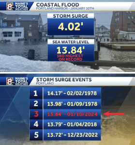
Marshall Point Lighthouse (photo by Steve Cartwright) Portlands measurements of peak winds and record storm surge events

What will tomorrow’s storm bring?
Beautiful blue skies were overhead two days later, with calm air and a near king tide and our own marsh in flood stage at the time of high tide (11:04 AM, Local Southern Island Hohonu Gauge observing 12.4 FT).


Tomorrow’s storm forecast is to be slightly less intense, but tomorrow’s tide will be this month’s king tide at 11:54 AM.


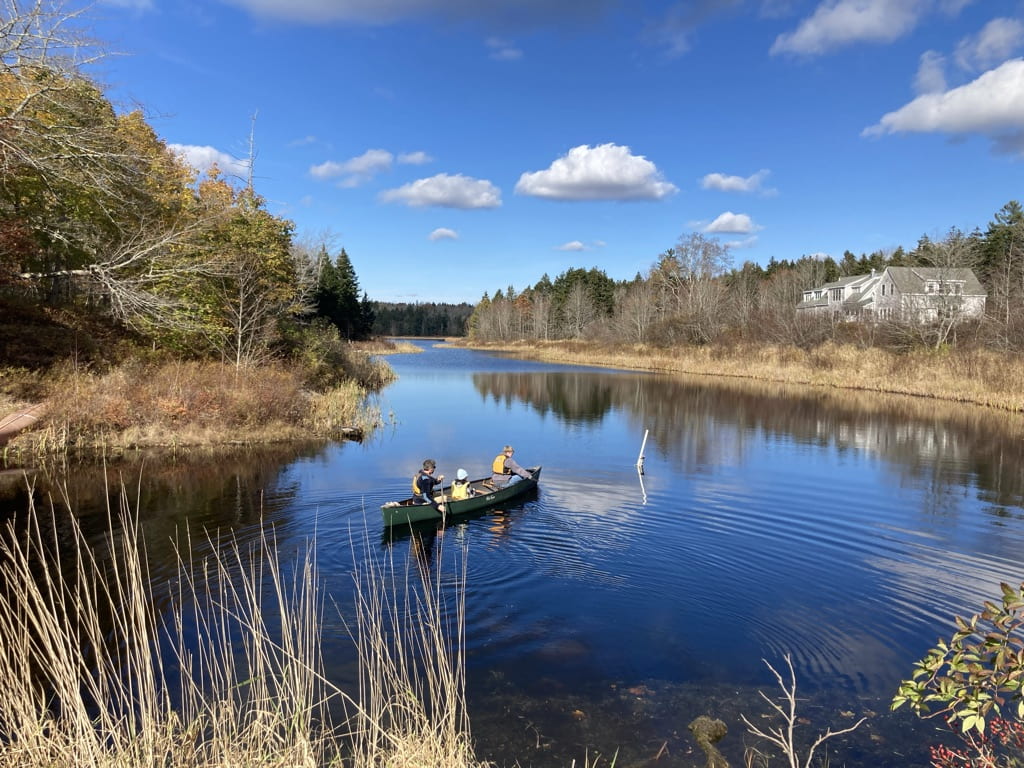
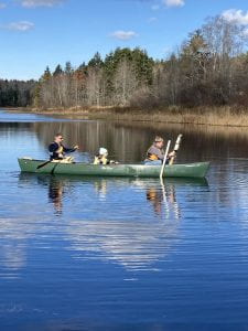
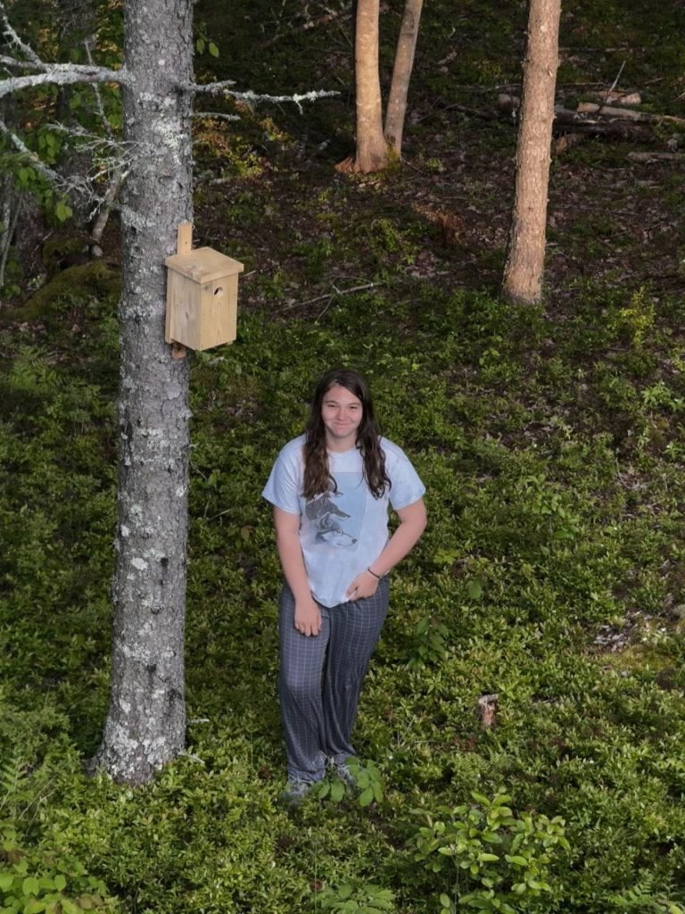
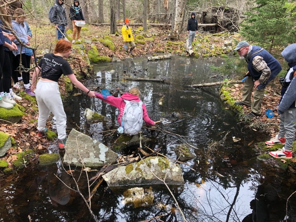
 We created migration stories using information about actual bird species, like the common nighthawk, or the bobolink, that showed their migratory movements that were picked up by Motus Stations that included Hog Island. We learned how important “stopover” areas are for migratory birds. These stopovers areas are places where the birds can rest and forage after flights so they can refuel and continue their journey to where they’ll breed and raise their young. We played a “hopscotch” game whose defined areas where we hopped represented habitats that in our game, may not be available to birds because of habitat changes like wildfire, or development, or pollution. It sure made it a long “hop” when those critical areas weren’t available. Thankfully, we sometimes have options to restore stopover areas, making sure that birds do have access to these vital areas.


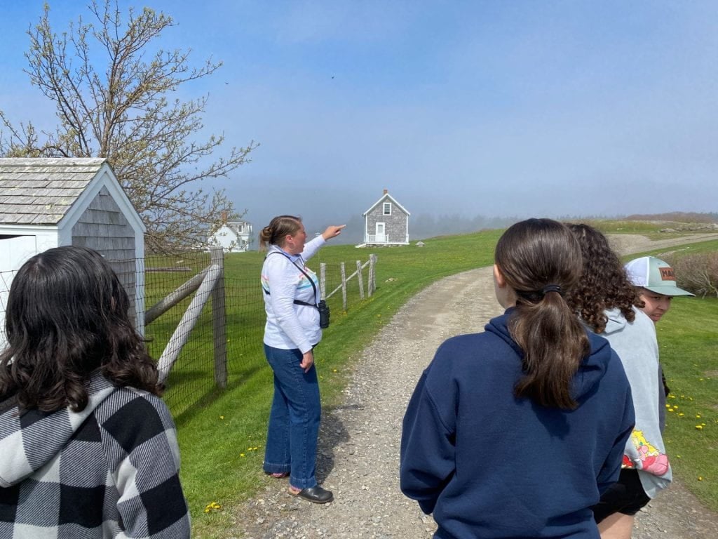
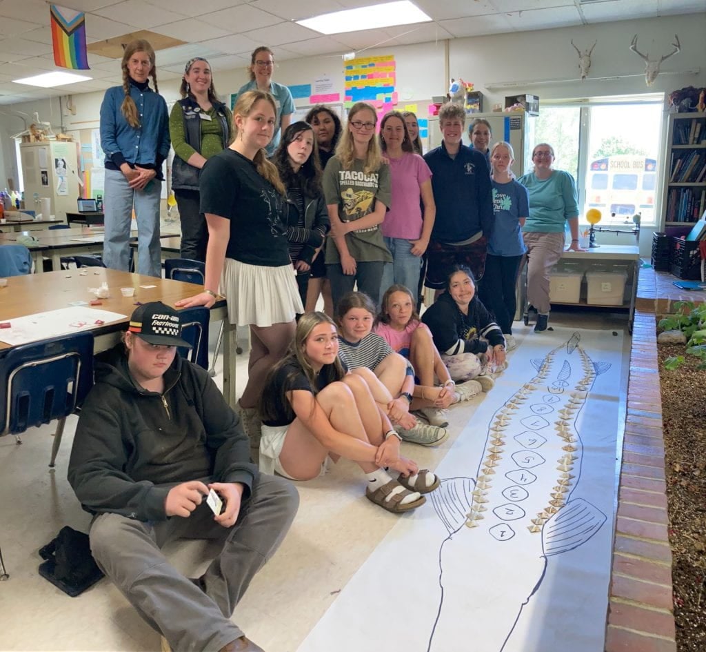
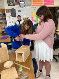
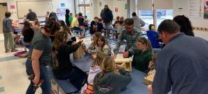
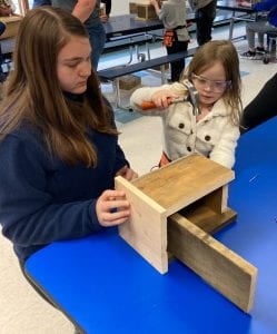
 It has been a whirlwind end of the year for 8th grade Science, with unique opportunities to see our learning topics applied: a field trip to Allen Island and a visit with Ecologist/Ornithologist Dr. Anna Forsman of Colby and a classroom visit from Artist Julie Crane and Herring Gut Coastal Science Educators to enlist our help in building (literally), awareness about how climate change can impact an iconic migratory fish species in Maine, the Atlantic sturgeon.


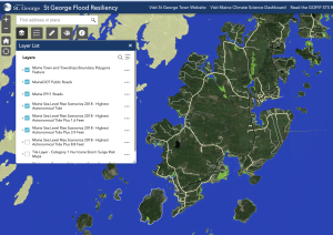
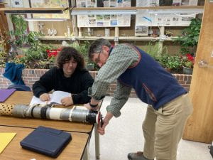
 On November 6th, the 8th Grade class was invited by Gulf of Maine Research Institute (GMRI) to meet in Port Clyde at the site of the relocated tide gauge that is an important part of our town’s planning for sea level rise resiliency for an introduction to the community sea level rise work that is going on.
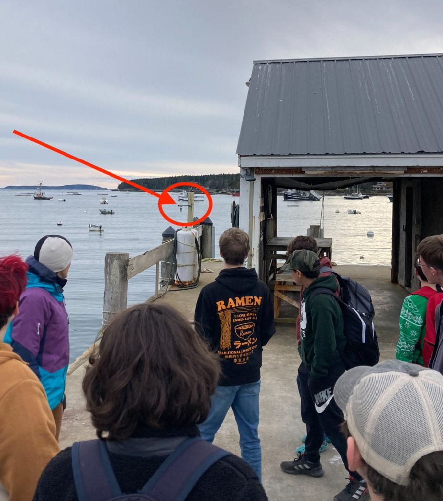 One of GMRI’s lead Climate Center scientists, Dr. Hannah Baranes, spoke to students about the town’s effort to collect tide data and introduced students to three other colleagues with her that day who worked together to install the gauge. They explained how the gauge uses ultrasound to sense the height of the water below the unit mounted on the side of the pier, and how their GPS staff “talked” to satellites to help establish the elevation of the gauge in its physical location and geographic surroundings to determine tide measurements.
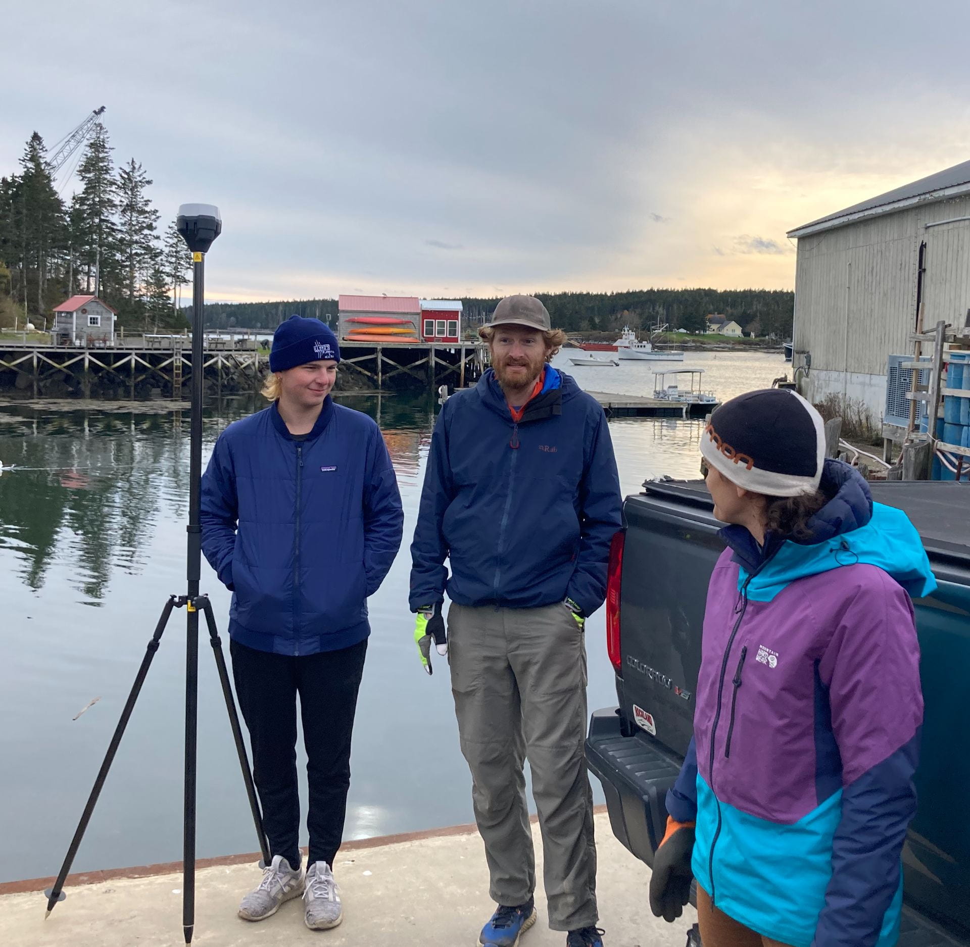


 Later this winter, students will be involved in observations that the town is interested in gathering from citizens that provide water level descriptions of vulnerable or impacted sights. These observations can now be paired with accurate data from the tide gauge to define specific impacts as well as help inform how local tidal changes are unfolding along our shores.