
Our class has been learning about topographic maps. Learning about topographic maps will help us learn about the watershed of the marsh. We are learning how the surrounding land of the marsh has the potential to affect the water quality of the marsh.

A topo map shows the elevation and the lay of the land. With a regular map, it only shows the streams, rivers, etc, but the topo map allows you to see which way the streams and rivers are flowing. Another thing that makes a topo map different is the contour lines. These lines tell you how steep or level the area is. The closer the contour lines are, the steeper the terrain. The farther apart they are, the more level the terrain.
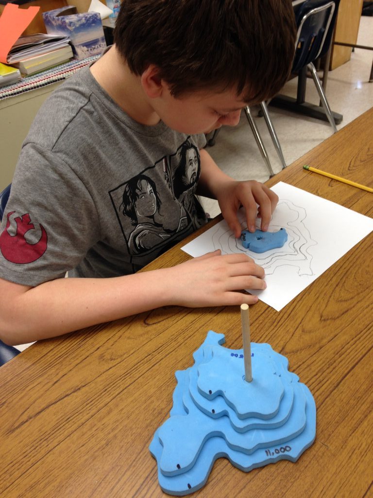
We used 3-D models of a land form to make our own topo maps. Our topo map displayed the elevations and we added our own imaginary hiking trails. These trails could be on a steep, more challenging path or a more gradual or level path. Next we made a side or profile view. This gave us a different way to interpret the contour lines of our landform on the topo map.
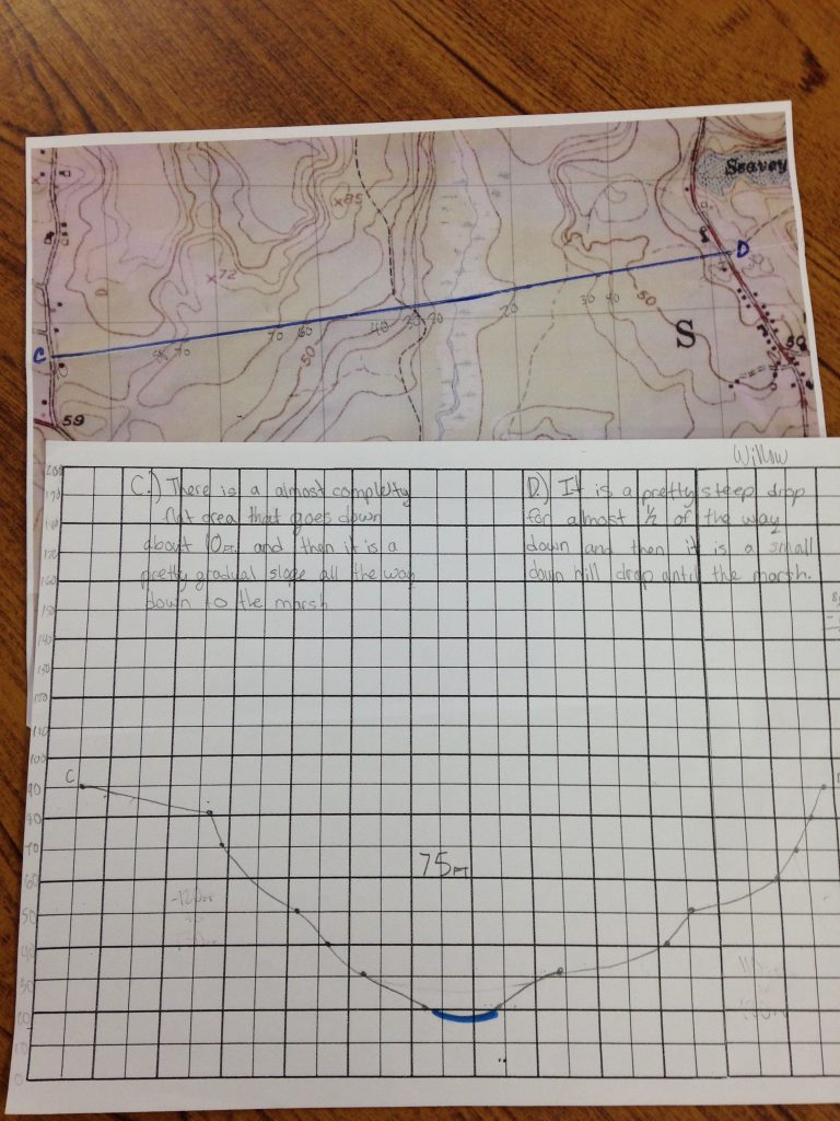
Learning about topography of the land around the Marsh let us understand the definition of a watershed because we could tell from the contour lines that the land sloped downhill to the Marsh. A watershed is an area of land that drains into a single river or body of water. Our watershed is nearly three square miles! We are excited to explore the next step in our watershed project.
Contributed by Willow McConnochie